|
SCRAPED! Anne & Lars Build a House |
|
Chapter 2: Topography |
The site is heavily wooded, and there's a house in the middle of it. A firm sense of its topography is hard to come by. So one of our first acts as owners was to commission a topographic survey. Here's the result:
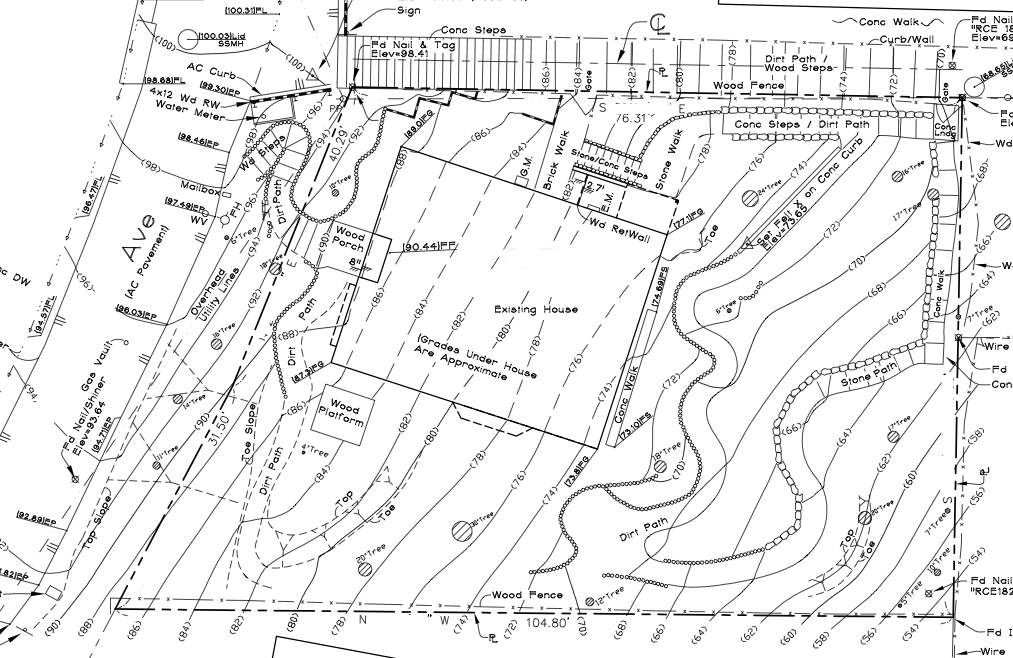
Topographic site survey North is up. The existing house is the big rectangle in the middle. Our street runs along the left (west) side at an angle, with a 10-foot strip of town land between the pavement and our property line. This is the high side, and the contour lines go consistently downward to the right (east). Aside from the street, the only other access to the property is a long, uneven set of public steps, made mostly of dirt, that run along the top (north) edge of the map. Fences border the property on all sides except the street side. Two gates allow access through the fence from the public steps, at top center and top right. Cross-hatched circles represent substantial trees, most of which are protected species. Several curving paths are also apparent on the site plan. These winding ways serve several large and small shrubs and trees tended by the previous owners, who were avid gardeners. The survey is information-rich, but it's still tough to generate a clear mental image from all those parallel lines. The next step was to layer sections of the survey onto a foam core model that is sliced into one-foot contours: 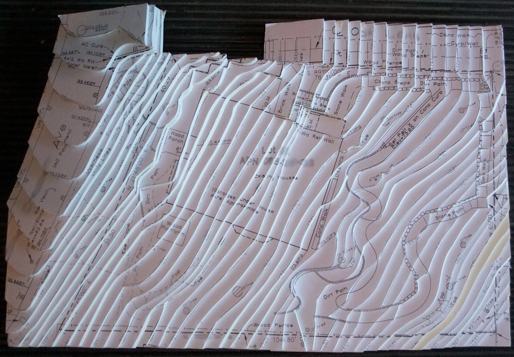
Topographic model The view above represents what you'd see if you strapped on a James Bond jetpack and hovered directly above the site (after clearing all the trees and painting the ground & roof white, of course). The missing chunk at top is a steep section of the public steps that I didn't take time to make out of foam. (This model took about 4 hours to make, not counting time to print out several copies of the survey. I think I could do it in about 2 hours next time. We'll see.) 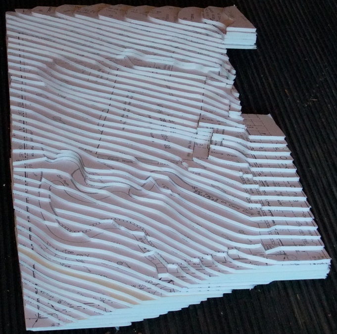
The site, from the air The model is now tilted away from the viewer. This view attempts to produce a better impression of the actual slope, by deemphasizing the site features, focusing more on the contours, and viewing the model on the level, as if you flew your jetpack eastward, down the hill toward the bay a bit, and then turned around and looked back to the west. So what do we learn from all this? It's a steep site, that's what! There's a 48-foot rise from the low corner of the property (southeast, lower left), to its high point (northwest, upper right), which covers about 100 feet of horizontal distance. That's right, it's nearly a 50% grade along the diagonal fall line, with the steepest portion running alongside the street. The garden paths are the closest things to level spots on the property. One of them even widens into a small dirt terrace at center left. We want to keep these intact. There's no reason for them to be anything but what they are now: nice little journeys around the wooded hillside. What kind of a house will occupy this thrilling slope? Follow this blog, dear reader, and find out! |